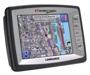
The Lowrance iWAY 600C is new in to the GPS market. It looks like this one will do well because of integrated satelite imagery which can be put on to the top of regular road maps. Currently the satellite images are only available in some main cities, but this is a great step forwards and no doubt the map updates that can be done through a USB port will also run updates for satellite images. I am not sure yet if you can upload custom satelite images or OS type maps, but if not then the device has still jumped in to a corner of the market not really tapped in to yet.
The iWAY 600C has the option of 2D and 3D maps and the usual turn by turn voice instructions which we are all familier with. The device runs on a 30Gb HD which can be used to store the images on. The screen is quite large at 5″ and runs at a nice resolution of 640 x 480. Going back to the hard drive, 85% is used for storing satellite images leaving the remaining 15% for updates to use. Hopefully the device’s internal drive can be upgraded as more sat images fill it’s memory, although you might not really need to keep high res images of the whole world if you only plan on visiting a city once. Just upload it for when you are there.
Via: UberGizmo


Speak Your Mind
You must be logged in to post a comment.